Paul Fischer
Professor Alicia Daniels
Natural History Journal
Spring 2017
Table of Contents
Glacial History of Vermont……………………….….……………………………………….....3
Tools and Historical Vermont Communities…….……………………………………………4-5
Naturally Curious Reading Response………....….…………………………….…………...6-14
Wetland Activity…………………………….……………………..……………………….15-16
Lending Library Activities…………………….…………………………………………...17-22
Field Notes…………………………………………………….…………………………...23-38
Walking in Nature……………………………………………….………………………....39-46
Paul Fischer
2/1/2017
Professor Alicia Daniels
Lake Vermont to Lake Champlain: A Truncated History
Lake Champlain is surrounded by the Lake Champlain Basin. This extends into Canada and New York as well as Vermont. While it today contributes to a vibrant ecology and superior forest cover in the region, it’s origins are a bit more frosty in nature. A massive glacier filled the modern Champlain Valley and for a short time pools surrounding it are now known as Lake Vermont, a temporally constrictive point (Wright, 5). The Laurentide Ice Sheet carved the depression in topology which lends the region a gradually changing elevation. This occurred nearly 23,000 years ago (2). The modern waterways and lake formed closer to 14,000 or 15,000 years ago (6).
The opposite event to global warming occurred, which is a fascinating geological phenomenon known as isostatic depression (8). In this process, rather than the seas rising, they were in fact much lower than we are experiencing currently, the land actually drops. Consequently, the modern Champlain Valley was actually the Champlain Sea! The history of the Sea is almost half as long, though undoubtedly much more biologically exciting, than that of lake Vermont, or about two thousand years.
Reference:
Wright, Stephen F. "Glacial Geology of the Burlington and Colchester 7.5’ Quadrangles, Northern Vermont." University of Vermont, Department of Geology. Burlington, Vermont 5405 (2003).
Paul Fischer
5/2/2017
Professor Alicia Daniels
Tools and Historical Vermont Communities
Human presence dates back to the archaic period and the site has returned some of Vermont’s only evidence of early fishing communities. Contemporary values in regard to the nature of the wetland were overthrown with the discovery of two dugout canoes in Shelburne Pond in the 1970s. By the 1980s these had been carbon dated to 500 and several thousand years old, respectively (figure 1). A discrepancy remains between these findings and the water working tools that have been discovered at other sites in the state.
A visit to the site at Shelburne Pond where the canoe was found returned the hatchet in figure 2. Due to rain, erosion, and previous archaeological digs in the region that included carbon dating, it could be a cultural or non-cultural object dating to up to 5000 years ago. A percussion test has not yet been performed, but that would confirm that the clear marks of chipping and impact were created by human hands.
Some of these tools are from before the year 2500 BCE, and indicate sustained human habitation (LCMM). Frequently they indicate familiarity and work conducted with the environment around them including wetlands. These communities were lost and today there is no Federally recognized Native American presence and are no reservations in the state.
Tools were fashioned from a variety of sources, from the soft blue-green quartzite of which there are great deposits throughout the state and neighboring regions, but also lime and granite. Shelburne Pond, despite international archaeological attention, continues to yield arrowheads, bone fragments, and other customary indications of civilization. Trading throughout the region was extant and research has not determined whether the dugout canoes were used to cross Lake Champlain, though they certainly would have been capable of this feat.
Early European contact with the French explorer Samuel de Champlain found that warring tribes were likely newcomers to the regions and in a sense colonists of their own sort from more established neighboring native American presence. This discovery in 1608 would not prove to be realistic to the actuality of continued Native American occupation. Over a dozen dugout canoes have been discovered and presented to the historical community by archeologists across Vermont.
Marine production continued until European contact and began centuries beforehand. The earliest confirmed dugout is estimated to date to 1900 BCE, though as already mentioned, sufficient evidence exists to suggest that more should remain almost or more than a millennium before this (LCMM). Archaic culture developed around 9000 BCE from the basic paleoindian cultures as communities swelled to more than around ten people at a time consisting of single families or small bands of families. As ideas spread, the interconnectivity of ideas with other Native American communities signified the entry of the Woodland period, during which time nearly all canoes date to. Future archeological digs should focus on digging into the origins of the design by demonstrating that the presence of water tools from the archaic period implies the presence of watercraft in a cogent fashion.
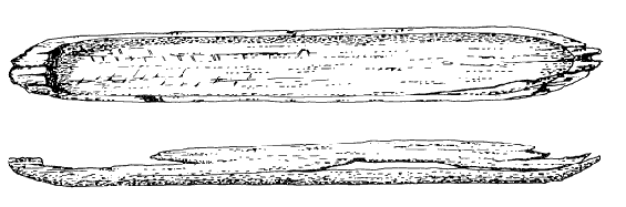
Figure 1: 550 year-old dugout canoe, Courtesy of the Lake Champlain Maritime Museum
Figure 2: Hatchet c. 3500 - c. 1500 B.C.E. Shelburne Pond, VT
References:
Lake Champlain Maritime Museum (2017).
Paul Fischer
4/2017
Professor Alicia Daniels
Significant Animals in New England
Three significant animals through the year will be followed, recording their mating habits, their interactions with other animals, and demonstrate their interconnectivity with the environment. Two amphibians, the four-toed salamander and the American bullfrog will give the reader an insight to the small scale night and day life of ponds and streams that many of us frequent. As a keystone mammal, the beaver will give a view into the rest of the ecological web with sufficient analysis and independent research has yielded figures that will be included as evidence of the winter and spring activities of this mammal in New England. Nesting parasitism and natural instinctive intellect will be evaluated using the American Robin, a natural engineer like the beaver who also has discerning qualities that set it apart from many other avian species. Finally a species Vermont is uniquely famous for, the Monarch Butterfly will demonstrate the complexity of natural ecosystems even on a nearly microscopic level.
North American Beaver
Before engineering, the first things everyone thinks of when a beaver is mentioned are the unique bright orange teeth that mark one of the mammal’s favorite pastimes: forest felling. In fact, they are not completely orange, but instead this appearance is from a layer of outer enamel that is harder than the rest of the dentin in the tooth (Holland, 353). As an herbivore, the largest rodent in North America actually uses the sharp, beveled edge created by movement of the incisors against lower teeth to fell trees, shorten twigs, and sharpen their teeth as a recreational activity as seen in figure 2.
Such dams are necessary for breeding as they give beavers access to the water where the mating occurs almost exclusively as well as to the surrounding environment in the bitter cold of the months January to March (407). The escape of beavers during the occasional January thaw to retrieve fresh food can be seen in tracks such as that in figure (368). Females have a short period of time when they are receptive to the attention of the male, around 22-24 hours, and a successful incident will result in between three and six kits, or young beavers, being born between May and July.
Young beavers will frequently spend several weeks of their life inside the dams, or lodges one of which can be viewed in figure 1 (84). This is because of another fascinating feature of beavers, the oil and castoreum used to grease and waterproof fur, that develops a little later. They will be driven from the home after a few years and before little siblings are born, meaning brother and sister are terms without meaning for beavers.
Oil to waterproof the beavers are not the only fascinating aspect of the beaver that adapts the prolific mammal to life in water and on land alike. In fact, the adaptations that allow the beaver to exist on land and underwater are numerous and relatively unique among rodent species (321-3). From webbed feet to a nictitating membrane, or transparent third eyelid, the top of the beaver to the tail has been dramatically altered for survival in a variety of warm and cold, dry and wet environments. Even the respiratory system of the beaver is fundamentally altered from that of other species to allow use of five times as much of the oxygen inhaled as humans and to voluntarily increase bloodflow to the brain allowing toleration of higher levels of CO2. To put that in perspective, some beavers might be able to survive, for a period at least, without a suit on parts of Mars, where oxygen levels run at under 1% the level found on Earth, though humans have permanent brain damage as levels of oxygen decrease to under 5% or even the 12% found at higher altitudes.
A high distribution of predators means that stealth is not only limited to ease of transport in multiple environments and naturally nocturnal behavior, but even the communication of beavers has been altered. Rather than using calls or acrobatic body language, their primary means of communication is through scent mounds of mud and vegetation mixed with pungent gland residue.
Four-toed Salamander
The four-toed salamander is unique among amphibians due to its secretive and nocturnal nature. Despite their stealth, they are found throughout New England and are noted for performing acrobatic while giving birth, depositing their eggs into depressions they have made in the moss seen in figure 4 (Holland, 37). I am reminded while reading of the American Woodcock, who creates the nest for their four eggs while in the act of mating by creating an indent in the grass or mud upon which they are lying. Males of that species also perform acrobatics, but prior to mating instead of subsequent to the act, in order to impress females seen in figure 3.
Although the salamander is largely inactive in the winter and difficult to find even in the summer as a secretive creature, because it mates in October it does not enter hibernation until as late as December (332). This is still not terribly late for the swampy areas where it can be found, such as the lowlands in Connecticut. A multitude of predators converge on the quiet salamander, and in addition to stealth, the ability to detach a tail and regrow that tail has become an evolutionary adaptation to this seasonal fluctuation. The indentation at the base of the tail and tissue allowing this can be seen clearly in figure 5.
The American Bullfrog
Amphibians, that include Four-Toed Salamanders, are equally as happy in the water as out of it. For the American Bullfrog, most of the lifespan will be spent in the mud (Holland, 37). In fact, in some extreme situations, there have been bullfrogs known to come back to life after extremely long periods in dormancy! Conversely, while resting in the hot summer sun, electrographic research has shown that they actually never sleep and are equally reactive while motionless as when obviously alert to stimuli (Hobson, 116-121).
The late emergence from hibernation necessitates this direct stimuli and also ensures the American Bullfrog’s place as among the most ferocious of carnivorous amphibians, though as a young tadpole they are normally herbivores (Holland, 158). Consuming most of the natural ecosystem around them, there are some parts of the country where you can actually help ecological systems by killing these invasive species. Their size also allows them to lay more eggs than many species of spawning fish and far more than other amphibians, with nearly 80,000 in number (Holland, 118). They experience a long period in as tadpoles as well, similarly to the mink or green frog, but otherwise unique among frogs and toads, that can last for up to two years (196). Other countries have also demonstrated serious issues with them when climate does not restrict their growth with the periodic dormant cycles which are natural and that allow them to swell to enormous proportions, feeding on even small mammals and avian species.
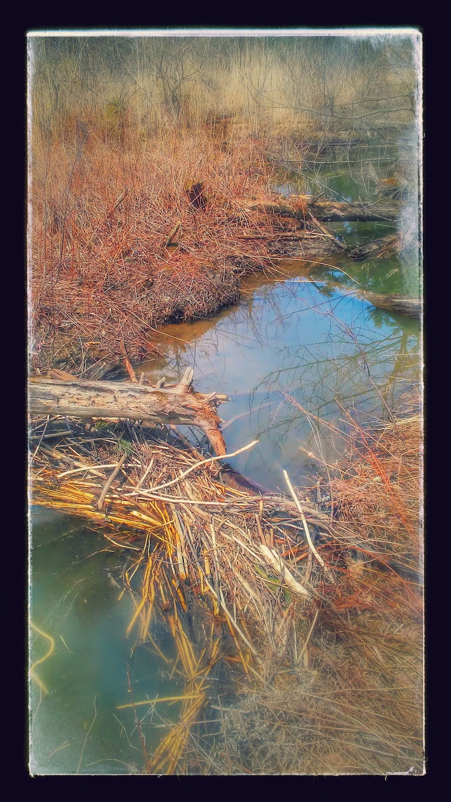
Figure 1: Beaver dam in a wetland
Centennial Woods Natural Preserve, Vermont, 2017
Figure 2: Evidence of beaver lodge-building activity
Centennial Woods Natural Preserve, Vermont, 2017
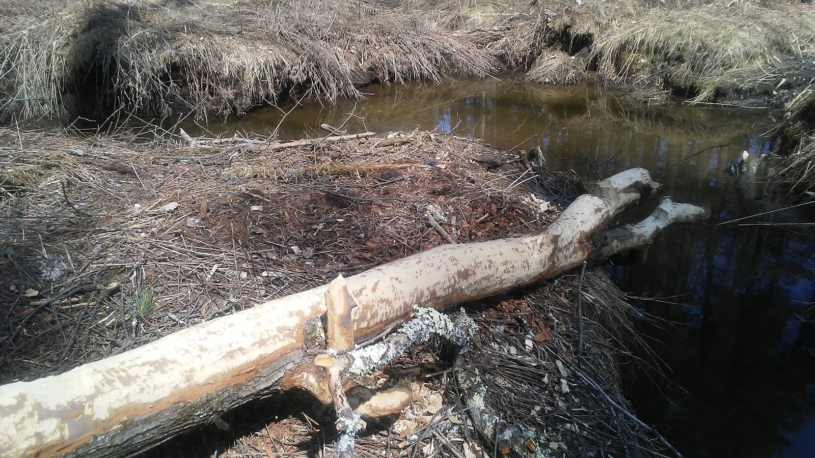
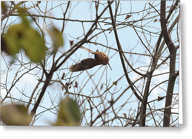
Figure 3: American Woodcock performing acrobatics to impress a mate
Courtesy of Asbed Iskedjian through fineartamerica.com
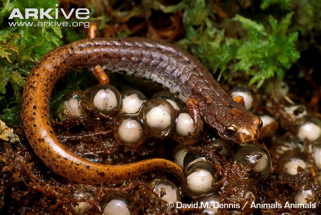
Figure 4: Four-Toed Salamander with eggs
Courtesy of David M. Dennis and Arkive.org

Figure 5: Four-Toe Salamander with Regrown Tail
Courtesy of Prince William Conservation Alliance
References:
Hobson, J. A. (1967). Electrographic correlates of behavior in the frog with special reference to sleep. Electroencephalography and clinical neurophysiology, 22(2), 113-121.
Holland, M. (2010). Naturally Curious. Trafalgar Square Books.
Williams, D. R. (2016). Mars fact sheet. NASA Goddard Space Flight Center: Greenbelt, MD Retrieved from http://nssdc. gsfc. nasa. gov/planetary/factsheet/marsfact (April 24, 2017).
Paul Fischer
3/1/2017
Professor Alicia Daniels
ID your Wetlands as Functionally Significant!
Criteria for a functionally significant wetland:
Flood Flow Alteration
| |
Upslope wetlands < 5% of the wetland’s watershed
| |
Wetland area <20% of watershed area
| |
Majority of the watershed is made of impervious surfaces
| |
Most soils (>80%) have a slow infiltration rate <.06” /hour
| |
Wetland is located near intermittent or first order stream
| |
Wetland > 81 hectares
| |
Surface Water Improvement
| |
Watershed => potential pollutants
| |
Majority of watershed != forest or scrub
| |
Wetland < 5% watershed acreage
| |
Upslope wetlands < 5% of the watershed
| |
Avg. slope > 10% in watershed
| |
Wetland type => riparian
| |
Soil Type histosol or frequently flooded mineralized soil with high clay and organic materials levels
| |
Near a 1st order or intermittent stream
| |
Wildlife Habitat
| |
1+ wetland of a different type bordering the wetland
| |
Least common among other watershed types
| |
Connection to surface water network
| |
A football field or more of natural vegetation along the perimeter of the defined wetland
| |
Hydrologically connected to another wetland within 400 meters
|
Reference:
Cedfeldt, Paul T., Mary C. Watzin, and Bruce Dingee Richardson. "Using GIS to identify functionally significant wetlands in the Northeastern United States." Environmental management 26, no. 1 (2000): 13-24.
Paul Fischer
Professor Alicia Daniels
A Birder's Bug Book
In the winter, a dead carcass can be a tempting source of parasites and infectious disease for rodents and local habitants of a region. The bird seen in figure 1 was likely covered in some form of toxic chemical in order to prevent other animals from consuming it. The interplay between species is interesting and the ecoweb is part of tracking the animals in the book.
In order to find a bird, it’s nutrition needs to be protected. Even though it looks gross, sometimes this can mean wasting a decomposing body. I could not have imagined this if it were not for ticks that clung to me at a later date, and my subsequent research into lyme disease, a new and terrifying epidemic in many parts of the country that originated in Connecticut.
Natural Communities
I was able to use this book consistently in sit spots and in field trips to evaluate the community in which we were looking at. The wetlands tied to clay and sand communities correlate to trees such as cedar and pine. These are frequently adjacent to streams that can form deltas.
Such relationships are critical to responsibly harvesting timber and to identifying potential deposits of interesting geological formations. This handbook is also useful because pictures of trees allow identification of a natural community using circumspect evidence. That can, for example, mean tree type determination instead of a soil sample can be adequate or vice-versa.
We were not able to take pH levels at many of our sites, but this guide also provides introspective evaluation of the levels available from undergrowth and other specie-related analysis. Combined analysis with “Forest Trees of Maine” was especially useful for me. This made it easy to actually find the natural communities referenced in this book. Please refer to the activity on page to see more opportunities to interactively become involved with the environment around you!
Forest Trees of Maine
I do not live in Maine. However, I found this book still useful for multiple qualities. Because many species in Maine also are present in communities in Vermont, this tree species guide can be used effectively in areas of Vermont. Each determining factor that makes this an effective guide will be addressed.
Sometimes the tree bark can be quite similar, as is the case with Hemlocks and White Pines (which are not quite, as the name suggests, white). This handy guide gives an interlocking guide to the leaf and seed dispersal methods of the trees. Because there are frequently remains of the trees’ flowering season even in the winter, it is possible to attain a positive identification of even tricky trees.
Other difficult question are exemplified with the difference between an American Beech and a Yellow Birch. In this case the young trees or saplings look nearly identical. As they mature however, a distinct difference in the ruffling of the bar emerges, so an adept forester learns to look for matured trees.
The final advantage pertains to this last example. While Vermont is a region of overlap between these two trees, this is not always the case. Between the two species, about half of the region that an American Beech occupies is not occupied by the Yellow Birch. So if you are not in New England and think you have found a rare grove of Yellow Birch with their distinct golden hue, look again and check for a young American Beech!
Tracking Mammals
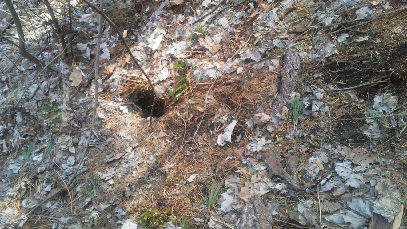
For tracking mammals I used a combination of footprint analysis and habitat evaluation to locate what I believed to be a beaver’s place of residence. Centennial Woods is home to multiple dams and varied markers of beaver activity. Woodchipping and sharpened twigs and stumps are all evidence of the occupation in the area by beavers.
Imagine my surprise when further habitat evaluation revealed the “beaver” in figure 1 was actually a woodchuck. The den seen in figure 2 is a typical of a woodchuck and research revealed that the two animals share their communities effectively. One notable difference between the species are sources of nutrition that do not conflict. Others include methods of communication, habitat already noted, and a pronounced tail on beavers that allows easy navigation of water.
Woodchucks do not have a particular affinity for water, though both are engineers. Their homes are specifically designed to stay cozy and warm using body and geothermal heat throughout a bitter winter. It is likely this picture was taken shortly after “groundhog day” seen in many cultures as an indicator of luck. Groundhogs are also hibernating mammals and natural engineers, which is actually the norm for many members of this family.
Figure 1: Remains of a bird either picked clean by rodent populations or chemically disposed of to prevent potential infection, Centennial Woods, VT
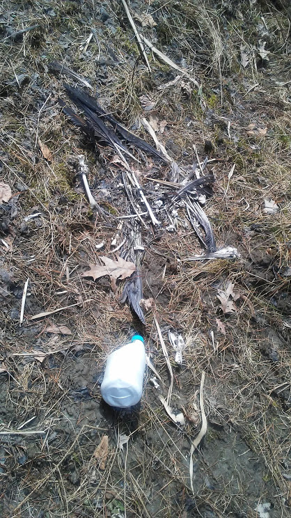
Figure 2: Woodchuck Den, Centennial Woods, VT
Paul Fischer
Professor Alicia Daniels
2/1 - Arm’s Grant
This is a piece of land that was in the Arm family for a very long time before it was turned over to the municipality, in part because of its unique natural communities as well as the proximity to state lands. The value of contiguous protected land multiplies in nature many times over. This is apparent in this region, where early mistreatment has been replaced by a permanent reserve for nature and recreation.
It rained on our trip to Arm’s Grant. Despite the early termination of the trip, one important contribution that can be identified to the experience was the difficult delineation between the American Beech and the valuable and rare Yellow Birch. In the American South this is an easy choice because the Yellow Birch is unique to the New England area. Arm’s Grant represents a piece of land where both can be identified. The papery ruffled bark of a birch can be seen in figures 1 and 2.
When this is the case, one thing that can be done is looking at the ruffle in the bark of the trees which is different in a way the texture and hue may not be. For those who have found saplings, this is a critical piece of information that a book on natural communities would later help create a utility towards determining more information about a region from correct identification of the tree species present.
Recreation and Fun Outside of Education
The area also makes for a prime cross-country skiing location and is frequented by local high school teams and classes who wish to capitalize on this valuable protected resource. Regular exercise can give emotional and intellectual benefits as well as an expected ten years in life expectancy. There is also a cohesive value for the community that is provided that creates a reciprocal relationship to the land and the communities upon it.
By learning about the incentives as well as the actualities of reserved land, our class had the opportunity to lay the groundwork to build ourselves into effective stewards of the land. Some attention was given to geological attributes and we were able to begin by identifying deer tracks, a concept that would spring up later in our work. Hopefully, in the future, it will be possible to return to the site with a more experienced eye. Or at least to say that should we, we certainly could.
2/22 - Raven Ridge
Raven Ridge was fascinating and we learned several facts about the site on our trip. Located in Hinesburg, the property was originally owned by the manager of Phish, one of the most popular bands to start at the University of Vermont. We stopped at several locations and were able to identify multiple items of relative importance. The 365-acre natural reserve is listed through the Nature Conservancy and provides explorers, natural scientists, and natural historians such as ourselves with a dramatically varied series of experiences.
The Dead Marshes
“Dreary and wearisome. Cold, clammy winter still held sway”
-Lord of the Rings, JRR Tolkien
The first two landscape facets that were apparent upon arriving were the frozen wetlands and the small mountains from which the name of the ridge garnered its name that are typical of Vermont’s rolling terrain of hills and valleys (figure 3). The area is a natural preserve now and was acquired after years of successful management. It is noteworthy for the presence of extremely rare animals as well as ancient geological activity that is very well apparent.
Unlike the marshes of Lord of the Rings, these marshes are not so dead. In the winter, amphibians hibernate up to a foot under the ground in the loamy ground and in the summer the area will be alive with a number of different populations of insects, birds, amphibians and more. But like Lord of the Rings, these marshes did lead us to our first chance to go spelunking (figures 4-6).
Golem?
“Trying to get up that great big hill of hope… I take a deep breath and get real real high and scream at the top of my lungs, ‘what’s going on?’”
-What’s up, Four Non-Blondes
In figure four, the entrance to the cave can be seen as a haphazard combination of glacial rock and temporal tertiary plate movement that resulted in the creation of the cave. Inside, an agile explorer who penned this journal was able to garner a photo of the innermost depth of the cave where some particularly secretive creatures may have lurked before the illumination of the area by virtue of a handy cellular light (figure 5). Finally in figure six I can be seen with students listening to the interesting acoustics created by the sandstone and granite cave as four non blondes plays from a small phone speaker.
Their lyrics about getting real real high became true as the group of novice spelunkers was confronted with a daring drop of a couple of stories. It was the only way out without scaling ice-covered rocks on the way back. A combat roll into forgiving snow allowed us to circle back to our waiting instructor. The heights, as is often the case, appeared much more daunting from the original perception than after, much like a famous feature-length children’s film, “Pooh’s Grand Adventure: The Search for Christopher Robin” in which children return to a terrifying series of natural phenomena on a bright summer’s day to find it had been a quite civilized experience after all. We still did not know what golem (or otherwise creature) might have once or actively inhabited the cave.
Sherlocking the Lichen and the Deer
Multiple factors alerted our group standing atop the ridge to the possibility that a population of healthily hungry deer were in occupation of the area. Perhaps the most telltale were the criss-cross patterns of hoof prints across the snow (figure 7). A more adept eye also found the trees had been stripped to eye level, an indication the deer were active here in the winter as well as the summer. This also gives a portrait of the ages of the family or herd of deer.
A closer inspection of the footprints revealed that some of them had been nuzzled by der as well. They were not in search of affection, but instead the rare lichen that is a delicate treat in the winter for the species (figure 8). This lies under the snow and can even conduct photosynthesis through the ice, a remarkable feat. Common deer and even the uncommon lichen were not the most notable of attributes sleuthed at this site, though.
Raven Ridge’s Rarest Features
Unfortunately, returning to the site will not be possible this summer. The reason for this is among the most fascinating parts of the reserve. Near a former cottage or shack that had burnt to the ground decades past, a tree had knee-height razor sharp incision marks. This was not the deflected mark of a distracted woodpecker nor a very unskilled lumberjack, but instead the sure and steady sharpening of the claws of a bobcat. Bobcats are among Vermont’s rarest animals, sightings can be counted in the dozens, and they roam the site freely in the summer time, leading to restrictions about the way in which the site can be accessed as the small mammals contain seemingly limitless energy and ferocity. They are highly intelligent and impeccable hunters.
They are almost as rare as rap stars at UVM, and a budding young duo recorded a rap using local verses underneath a geological formation that indicates dramatic terra-shifts in times before human habitation. The natural auditorium created by a combination of heat and pressure is dubbed “the oven” and can be seen in figure 9. The glacial contributors to this rock formation are partially responsible for the federal recognition of the site as biologically significant; the area was once an island, 15,000 years ago or more in the time of Lake Vermont.
3/15 Cuckoos and Roaring Springs at Sunny Hollow
Sunny Hollow provided the class with examples of delta natural landscapes and terraced natural preserves. We also reinforced our historical knowledge about the timeline of the state. Most importantly, it allowed acquaintance with the Fellowship of the Wheel, an organization responsible for ensuring the enforcement of the natural right to access recreational areas for wheeled activities. I was able to donate a golden wheel to the sign, that remains in place today (figure 10). The Fellowship of the Wheel is an active non-profit organization that maintains over 120 miles of trails across Vermont and won an award in 2013 for their work that constitutes over 1000 hours of volunteer work annually.
Natural Landscapes and Tree Species
Most deltas are clay-bottom natural communities. This area is marked by an active population of wildlife and forestry. One issue is a lack of fires, ironically enough. Tribal leaders in the area once ensured that controlled fires routinely cleared away brush and renewed the soil, but proximity to residential areas in Colchester has made this impossible currently, and a disheveled, though vibrant, natural community is apparent. That being said, it would certainly aid in the trying wait that occurs each spring for the trails to dry for cyclers and other travelers if only it could be carried out in a controlled fashion.
Dogs of War: Last Trees Standing
“See the fields burning ‘cus hell is coming through, I can’t stop the dogs of war”
Dogs of War, Blues Saraceno
Hemlocks are present, but a dominant species in the area is the pitch pine (figure 11). An interesting fact that I learned about this remarkable species of pine is that they actually have self-defense mechanisms that wage war on other trees! In order to protect themselves, they will increase and exacerbate destruction wreaked on surrounding natural life.
To explain that provocative fact, it is necessary to understand that the name for the trees is actually literally derived and what function that has. Pitch is sticky and has a lower temperature of incineration to standard wood. It will surround the tree, especially during hot summer months, in such great quantities that the pitch has been used in times past to make torches or even to prepare cauldrons. Other uses include as an adhesive and sealant.
The interior of the pitch pine is circumnavigated by a “sheath” that does not catch fire easily. Between these two features, the pitchpine will often be the only species standing after a fire. This is an example of intergenerational competition that is rare in animal or even human cultures but does occur in the natural world.
Springs (without cogs, boat or metal) and Trees
As one approaches the creek and the roaring river in the springtime, the hemlocks begin to dominate the landscape (figure 12). These proceed all the way down to the bank and are interspersed with cedar and oaks. One somewhat rare occurrence for the region was the presence of black oaks (figure 13).
Speaking of oaks, sometimes developmental stages are critical for trees, like humans. The white oak in figure 14 shows evidence of an early basal scar. The benefactor is likely a small mammal or a family who might use this area to hibernate. Some habitats are manmade, such as a cuckoo home we found along the way (figure 15).
Finally, not only is the pitch pine found in the region, but also red pines (figure 16). These look white, but should not be mistaken for their wrinkly cousins. The clay-like patchform bark is distinctively useful for the purpose of identification.
3/22 Church Woods and Craft Party
Maple is among the oldest and most reliable streams of revenue for the state of Vermont (figure 17). Both sugar and silver maples were abundant on our trip to one of the oldest and most reliable utopian farms constructed in Shelburne, where a horse barn, cheese factory, and maple syrup operations are just a few of the many attractions available for natural historians and other interested community members. Aerial photography was critical towards describing a natural landscape scheme and a secret accidental historical surprise was revealed in a short lesson. The biting wind touched our ears and my exposed ankles were heckled by the bite of knee deep snow as our group explored the striking landscape and what natural history could be gleaned from the territory at our disposal.
An Ancient History
Church woods has a history of spiritual commensalism with the land and communities who have inhabited this land. The trees in the area, however, are not immune to infection and erosion, so a downed tree such as can be seen in figure 18 with an impressive root structure may be a regular occurrence. What combinations of events could bring down such a massive resident of the area? We will find out shortly.
As it turns out, the land is connected to Shelburne Bay by means of terrestrial and underground streams. These lend a unique nature to the species of trees, wildlife, and shrubbery in the area. They can also shift, leading to bizarre changes in the area. From the sky, they appear to make a cat scratch, or three stripes from the increased hydration available in the areas surrounding these streams. This is ironical because in addition to turkey populations natural to the area, bobcats and other wildlife have also been spotted here.
Divine Guidance
In keeping with the ancient history of spirituality associated with the site, in modern history a discovery in the 1970s demonstrated an enormous level of chance. While most of Shelburne Farms was clearcut, Church Woods was left uncut for spiritual reasons. Nothing was thought to be particularly fascinating about the site, and it was ordered to be cut to provide a field.
It just happened that in addition to being a forester, the lumberjack was also a historian. Upon taking a single wedge from one of the red cedars in the grove, he noticed that an enormous number of rings were enclosed by the bark. Further analysis proved the area to be one of the areas of old growth, in New England as rare as Redwoods in the West. The trees dated back to early periods of contact between Europeans and tribes present in the region.
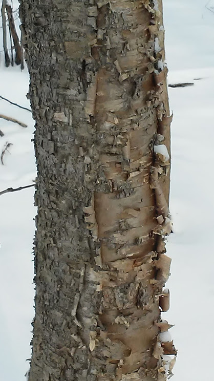
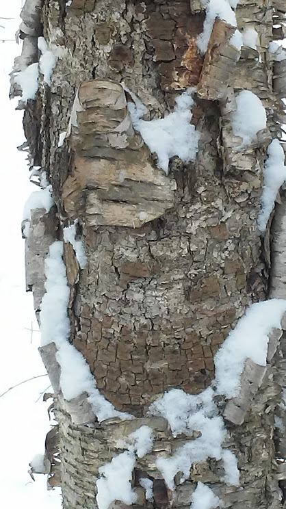
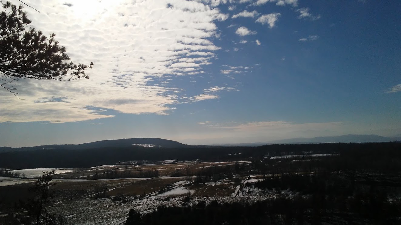
Figure 1: Birch bark, Arms Forest, VT Figure 2: Ruffled bark, Arms Forest, VT
Figure 3: Raven Ridge Valley and Mountains, Raven Ridge, VT
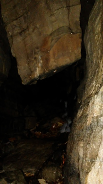
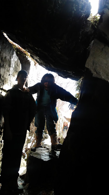
Figure 4: Cave Entrance, Raven Ridge, VT
Figure 5: A Mysterious Lair, Raven Ridge, VT


Figure 6: Inside the Cave! Raven Ridge, VT
Figure 7: Deer Print with Buried Lichen, Raven Ridge, VT
Figure 8: Lichen Sample, Raven Ridge, VT

Figure 9: The Oven, Raven Ridge, VT

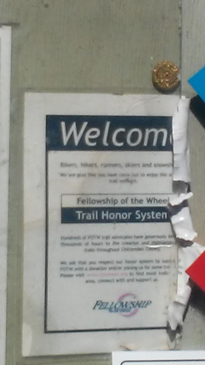
Figure 10: Fellowship of the Wheel, Sunny Hollow, VT
 Figure 11: Pitch Pine, Sunny Hollow, VT
Figure 12: Hemlock Dominant Tree Cover, Sunny Hollow, VT
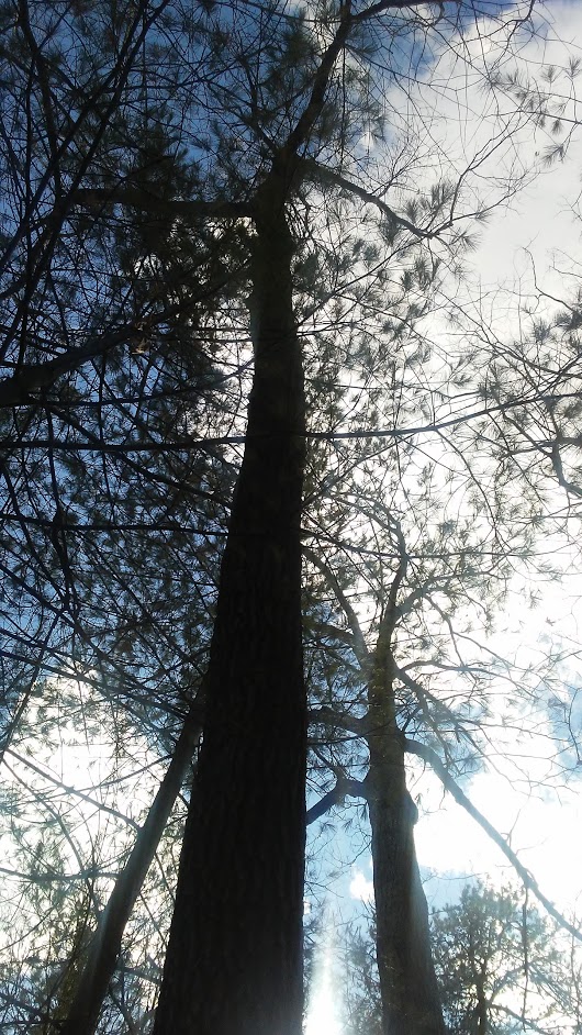
Figure 13: Black Oaks, Sunny Hollow, VT

Figure 14: Great White Oak with Basal Scar, Sunny Hollow, VT
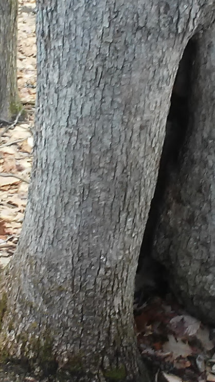
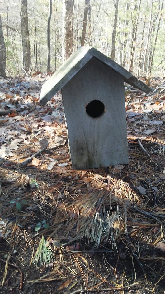
Figure 15: Cuckoo! Sunny Hollow, VT
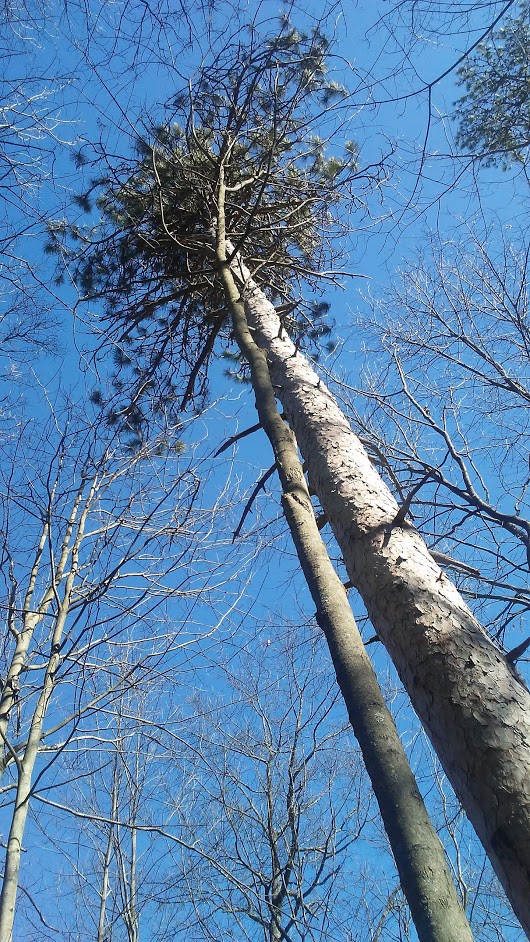
Figure 16: Red Pine, Sunny Hollow, VT
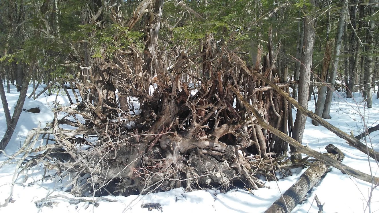
Figure 17: Tree Root Structure, Church Woods, Shelburne Farms, VT
Paul Fischer
Professor Alicia Daniels
2/2017
Walk in Nature 1
Last night my roommate had a group of au-peres she leads over for a presentation so when I got back from the library in the evening I took a long walk around centennial park. I slipped and slid on the icy ground which is evident in an attached photo of a tree on campus as I explored the natural reserve for wildlife and refuge of wilderness behind me. The terrain was, naturally, hilly and densely populated with the remains of the summer’s growth.
As the land flattened, marshes became apparent with bridges made useless by connecting stretches of ice and snow. I stopped at the end to notice a slowly moving brook which passed by a distinctively red barked small tree or brush. Perhaps it was a young red maple or oak. It could also have been as diverse as a hornbeam or tupelo or sumac, according to our field guide. The red bark was completely ensconced in a sheet of ice which had rapidly froze around the bark, appearing to magnify it to the eye.
-
Figure 1: Ice and Tree, UVM

Walking Nature 2
On the way back from work I had the opportunity to walk through the green way up by the University of Vermont’s Horticulture center and research fields. There had once been small solar panels on a field there and now there is just one or two large solar panels. The snow was coming down heavily and I listened to music from Bruckner using Youtube Music. By the time I got back, a young man would remark, “Wow! So much snow just fell out of your hair.” Obviously this was before I got a haircut.
It was bizarre to see the research fields covered in snow, usually they abound with bizarrely colored crops and/or signs demarcating the nature of the corporate sponsors and such. The horses across the street had jackets on but seemed unperturbed by the falling snow, a full belly of oats and grain likely fueled their stand against the coming winter. A runner or two passed by and their face was illuminated by the glow of my electronic cigarette as I took a moment to turn away from the lighted path shortly. The natural area was interrupted drastically by a fence, though, and the cultivated nature took a new nature of civilization as it transformed into a series of golfing holes. I found no incentive to investigate further.
Walking Nature 3
I recently came to the Generator for a class and orientation early. My phone must have been set in German hours or something when I made my calendar date because I showed up at 10:30 and nothing happened there until 4:30! It turned out to be great though, I got the opportunity to walk up and down my coast line and caught some spectacular photos which will be attached.
Figure 2: Stone Circle with the Sun and Moon in Winter, Red Rocks, South Burlington, VT

Figure 3: When Burlington Looked like Greenland, Burlington, VT

Figure 4: Lighthouse and Waterfront View, Burlington, VT

Figure 5: An Artistic After-Walk Treat, South Burlington, VT
Artistic Credit: Mark, The Generator

Walk in Nature 4
This is part of another assignment, but as an hour-long detour on the hike, I had the opportunity to conduct some real life modern archaeology. In figure 6, what looks like a chemical weapons container is likely the remnants of an old milk or fuel container that spilled from a passing truck on the nearby Vietnam Memorial Highway. It has rusted away and its contents spilled into a nearby underpass for drainage.
This occurred probably many decades ago but still raises a serious question about the efficacy of a natural preserve on a former landfill so close to an area of major transit. Standard welfare unit evaluations place the value of an animal’s life at between 4% and 5% that of a human’s. When an area’s animals are in danger of extermination, as is the case with a particularly dangerous toxic spill the logic behind such belief begins to fall apart.
In fact, international law condones the incarceration, execution, or shoot on sight orders for large numbers of militia, criminal, or other nefarious organization responsible for taking such action with sanctioned poaching laws. Using this logic, that ratio mentioned above can be easily turned on its head, even more so. To be completely fair, given a random human and 23 random animals, to take another extreme, there would never be a situation in which these ratio are reversed.
Walking Nature 5
Eager for more, I continued my search for archaeological finds in the area. It was clear that human activity in the area had been markedly increased to today in decades past. Remnants of smaller power lines accompanied a burnt maintenance shed (figure 7).
Sometimes the anthropogenic of a natural community can be fascinating as well as the spring life that is springing up around it. The rusted cogs and axel seen in figures 8 and 9 indicate such a demonstration. It can be inferred that in a certain metaphorically stimulating sense that the presence of man in this area subsumed itself. Ultimately fire removed most traces but this picturesque almost post-apocalyptic remnant.
Figure 6: Rusted Spacesuit helmet, fuel tank, or milk canister? Centennial Woods, VT
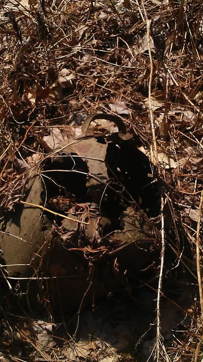
Figure 7: Old Powerlines Centennial Woods, VT 
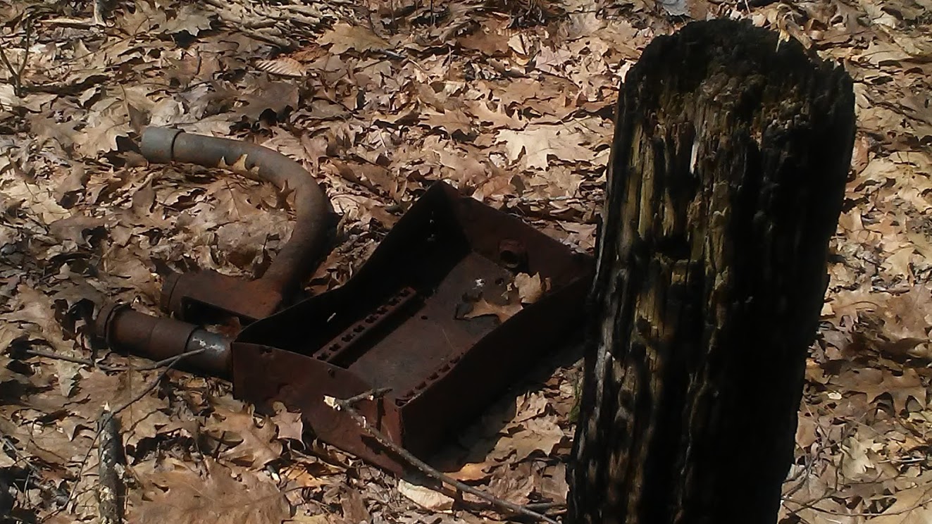
Figure 8: Gearbox and burnt foundational stump, Centennial Woods, VT
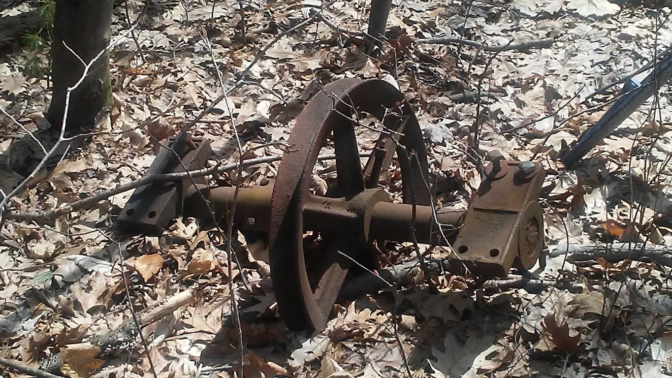
Figure 9: Axle and wheel, from an old shed, Centennial Woods, VT
No comments:
Post a Comment